06 April 1998
"The Poolville Supercell"
Tim and I left Norman around 2pm and headed southwest. We
drove under some stratiform clouds and light rain for an hour an a half
(which we were expecting from prior inspection of visible satellite images)
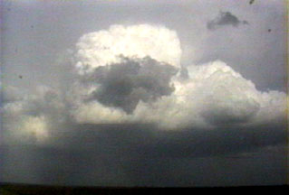
and then broke through it, still east of the dryline. We saw some building
cu to the north and what looked like a pretty disorganized storm to the
south (based on the anvil looking thin and crappy, mainly) so we stopped
to get data on Tim's laptop in a town whose name I forget at the moment
(could reconstruct if I had a map in front of me). There was a dry punch
at mid levels and Tim felt it was critical that we get the data to find
out what it was doing before we made our decision to go north or south.
We knew the storms would be fast moving so time was of the essence. On
inspection of the data, we decided to go south and try to get SE of the
storm there, whose anvil appeared to be pulling together as we got the
data, and for which a tornado warning (radar indicated) had just been issued.
It took us awhile to get southeast of the storm because it was moving FAST
(about 50mph or so). As we got closer and had better visual resolution,
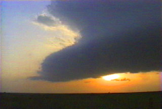
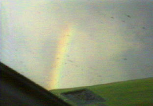
we saw a strong hail core with a nice rainbow attached, and a fairly solid
updraft base with a decent wall cloud just southwest of the hail. The flanking
line was cycling back and forth between being composed of discrete cells
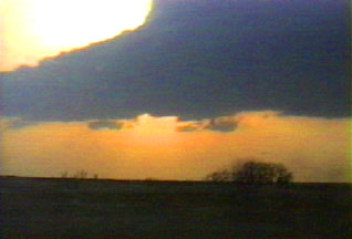
and looking like a doorstop. Unfortunately, the contrast was pretty poor
much of the time due to our position in between the sun and the storm.
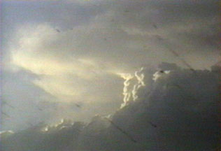
Once we got SE of it we got some nice backlit shots. We saw several disorganized
wall clouds form and dissipate, none of which produced any funnels but
at least two of which had pronounced rotation. Tim positioned us in between
one of these and the RFD at one point, and the RFD kicked up a bunch of
dust (which is red-orange around here) that was getting sucked up toward
the rotation. At this point I didn't realize it was the RFD - I thought
it was a tornado forming, and I panicked a bit because we were so close.
I begged Tim to go south, and he did. Once he explained what had happened
and that he was expecting it, I felt a bit silly, but it was still just
a little too intense for me in my novice state. Tim captured some of my
panic on video which promises to be amusing. We followed the storm east
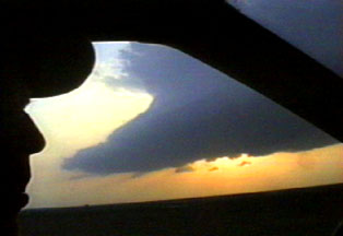
just south of the updraft as the sun set, hoping for a good lightning show.
There was some decent lightning, but nothing spectacular. After we lost
the heating the storm appeared to weaken quickly (about an hour after darkness
we noticed a substantial decrease in lightning). We saw a plane seeding
the storm with dry ice to suppress hail while Tim was getting some lightning
stills. We followed the storm back to I-35 about 10 miles north of Ardmore,
then headed to Pizza Hut in Ardmore for dinner around 9pm. We got back
to Norman at midnight. Fraser tells me there was some small hail in Norman,
which was from the same storm we were on. All in all it was a very satisfying
first chase of 1998 for me.


These images are in chronological order and are all Copyright 1998 Shannon
Key
Data from 04/06/98:


Click on an image to enlarge it.
Back Home
My Other Chase Logs